
Winter Storm Update (1:55 pm CST) 12-28-2025
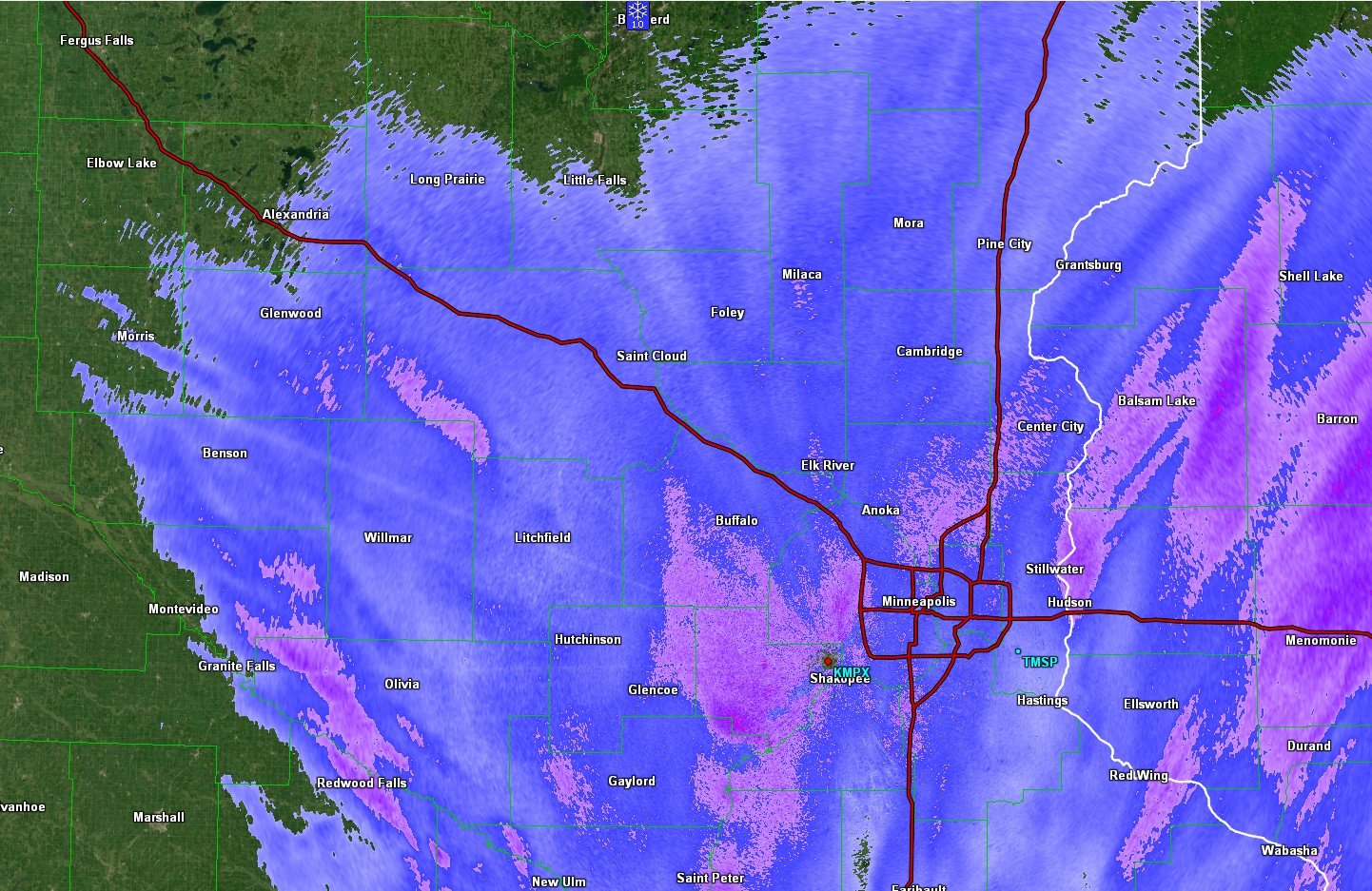
Radar snapshot from 1:45 PM CST.
Update: 1:55 pm CST
This afternoon’s snowstorm is continuing to make progress across the region. As of 12:00 pm CST, Minneapolis-St Paul International Airport is reporting in at 2 inches, the National Weather Service office in Chanhassen is reporting in at 1.9 inches, and Bloomington is reporting in at 1.8 inches. Brainerd is also reporting in at 1 inch as of 1:00 pm CST.
As we move through the afternoon, the big issue is going to be the strong winds gusting as high as 40 miles per hour, which will reduce visibility. Temps will also start to drop as we head into the overnight hours as an Arctic cold front moves through the region.
As of 1:00 p.m., St. Cloud Regional Airport was reporting winds out of the Northwest at 18 miles per hour with gusts as high as 30 miles per hour. Buffalo Airport was reporting winds at 18 miles per hour and gusts as high as 25 miles per hour.
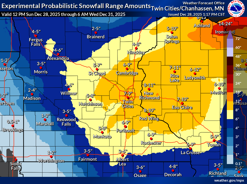
As of 1:00 p.m., the snow totals are still trending in the 6 to 9 inches range for central Minnesota, and isolated spots could see 10 inches.
Overnight tonight, we will drop to a low of around 8 degrees with windchill values as -14 degrees. The cold trend will continue through the upcoming week.