
An Active Week Ahead
As we start to get towards the latter half of February, and the long standing of tradition of the Groundhog Punxsutawney. We have around “six more weeks of winter”. However, we all know the special event held in Pennsylvania is just a good old wise tale.
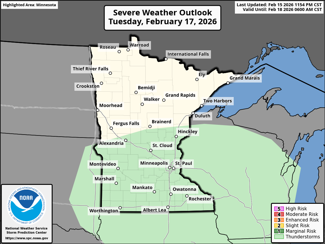
For us here in Central Minnesota, we do have a bit of an active weather pattern as we head into the second half of this week, beginning on Wednesday. An area of low pressure is going to build up on the border of North Dakota and South Dakota. Which will make way for some mixed precipitation.
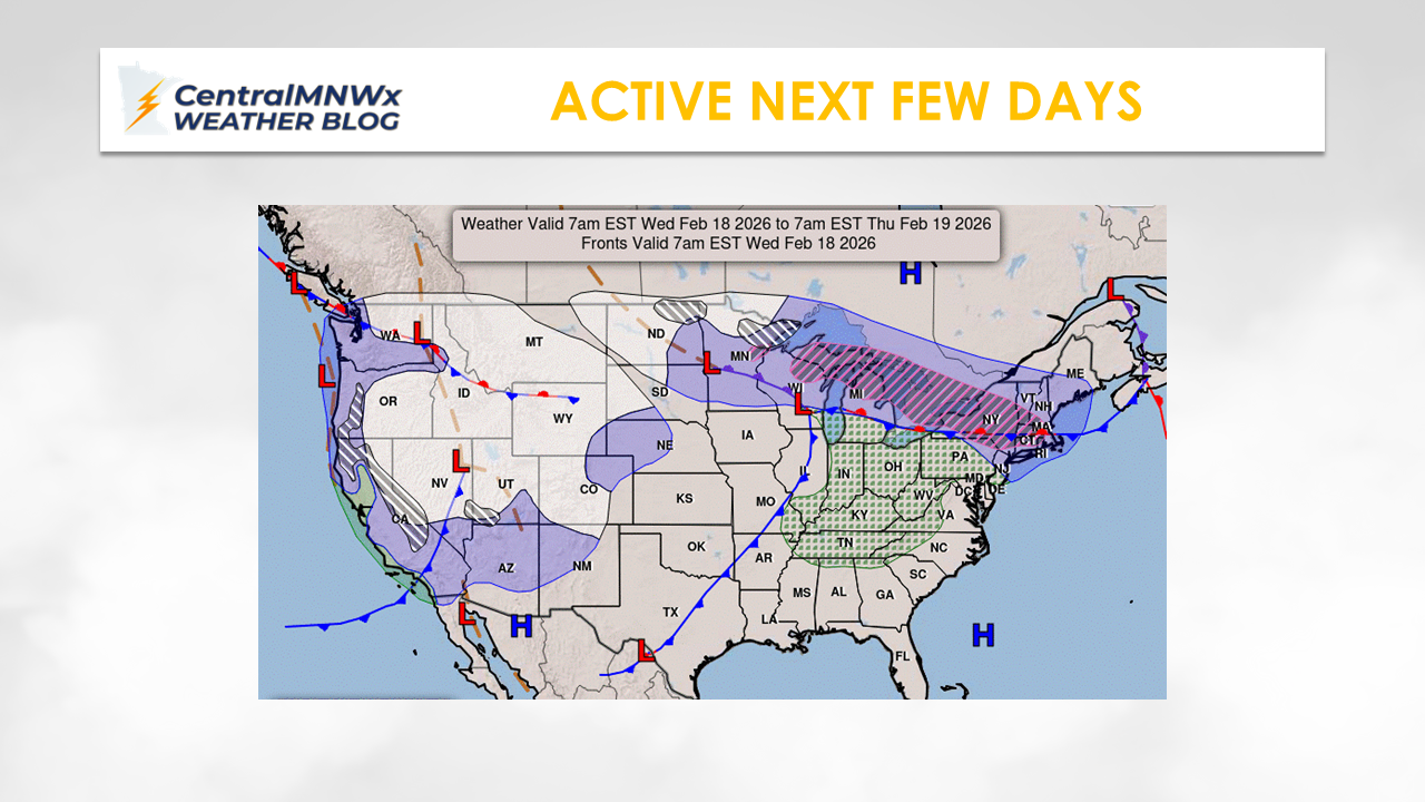
Back in Central Minnesota and parts of the metro, we still don’t know how much rain or snow we will see. We should have a better idea in the next 32 hours as models start to align. For storm lovers, for Central Minnesota and Southern Minnesota, there could be a few rumbles of thunder as the cold front moves in on Tuesday.
What we know right now, is late Wednesday afternoon into the overnight hours, will bring mostly rain to start. As the system moves north of Central Minnesota, it will transition to mostly snow for folks up north.
Current models are suggesting upwards of 8 plus inches of snow across the North Shore.
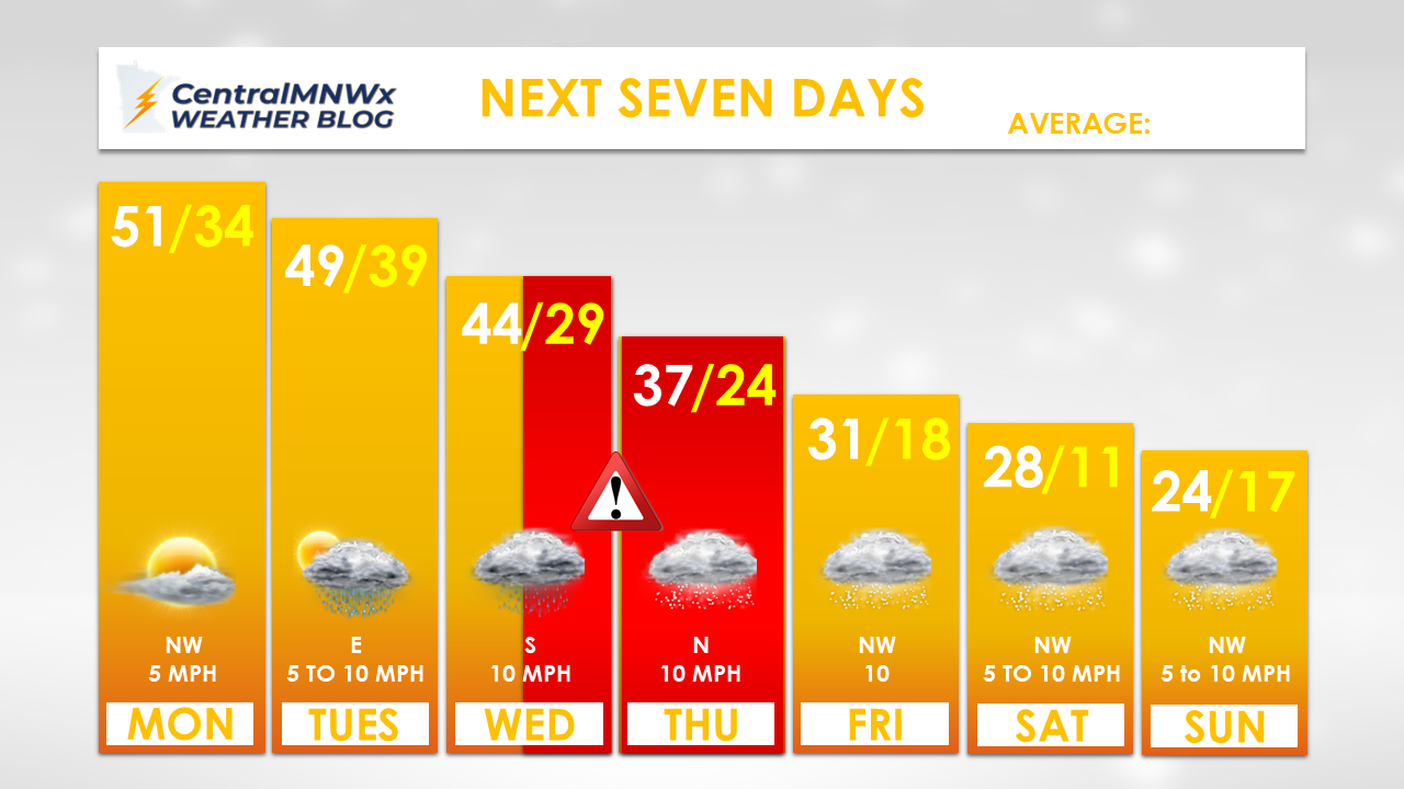
Once the cold front moves through, we will also see a steep dip in temperatures by Friday.