
Minnesota’s Most Detailed Forecast: December 27th, 2025
Today
Big Snowstorm:
For the last week, models have been pretty relaxed as far as the threat of any major snow. However, in the last 72-hours, the GFS and Euro models have all started to align for the possibility of significant snow across the Upper Midwest, Great Lakes, and Middle Mississippi Valley regions.
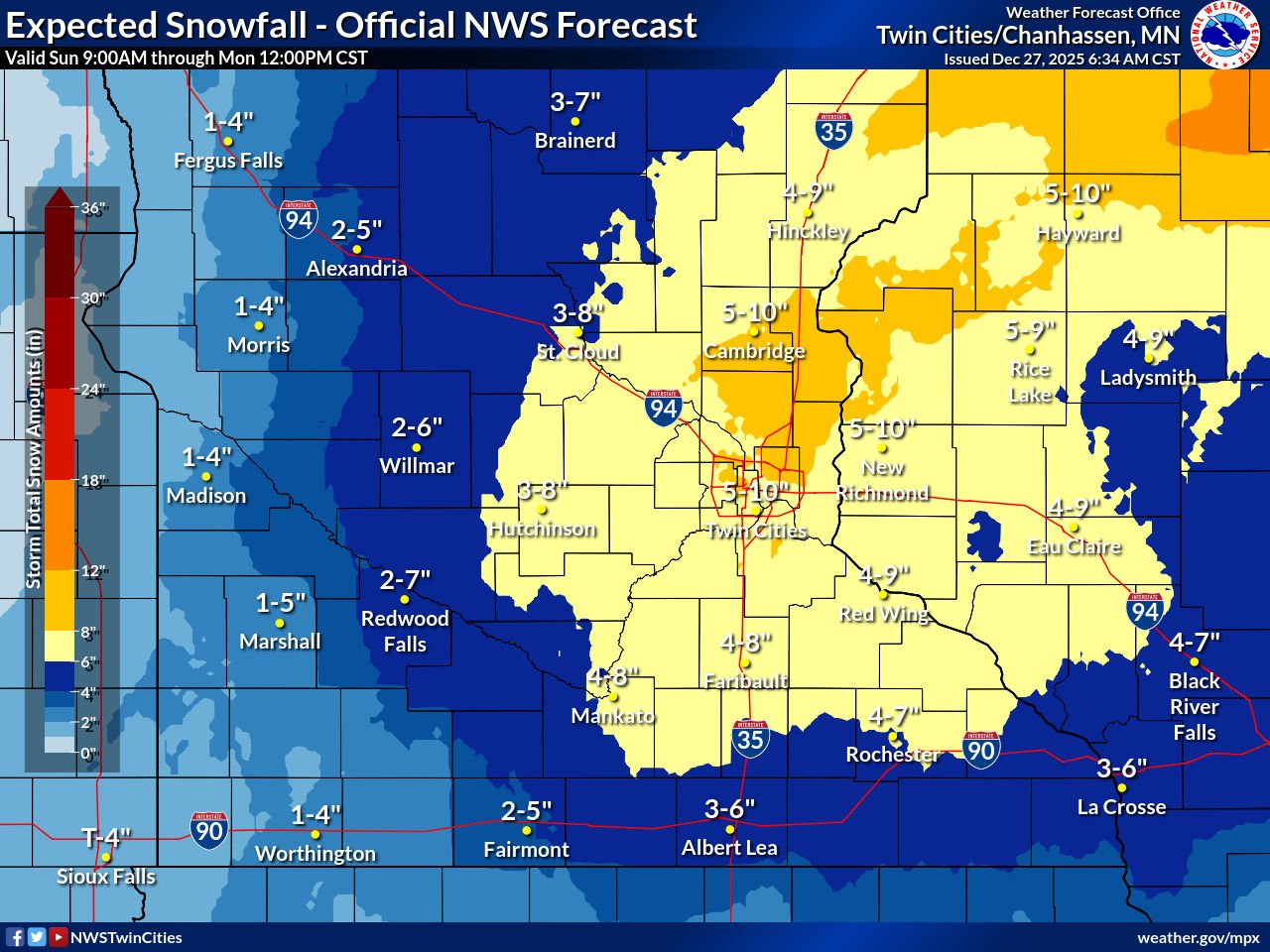
The latest models are showing 3-8 inches across Central, East Central, and Eastern Minnesota, with an isolated 8 to 11 inches of snow on the higher end. Western Minnesota will get around 2 to 6 inches.
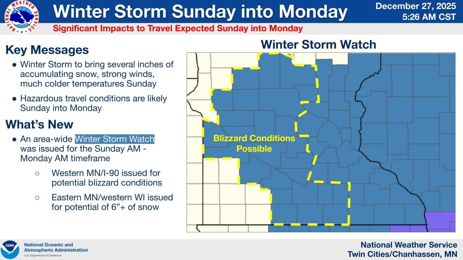
Another factor in the winter snowstorm is going be the wind and the potential for flash freezing. As indicated on the map below, there is the possibility of Blizzard Conditions due to strong winds and blowing snow. The timing for this entire system is from early Sunday morning through noon Monday. During the main weather event, travel only if necessary. With there being a risk for moderate snowfall, I would not be surprised if we see snowfall rates at a half inch to an inch of snow per hour.
Twin-Cities Almanac:
The record for high temperature set back in 1994 was 45 degrees. The lowest temperature for the region was set back in 2003 at 36 degrees.
The highest recorded snowfall total for the region was set back in 1982 at 4.5 inches. The lowest snowfall total was set back in 2024 at 0 inches.
This Week
Once we get past our upcoming snowstorm, we will see temperatures in the low 30s to below freezing for most of the week. Winds will be mostly out of the west-northwest. Throughout the week, our overnight lows will stay near zero and subfreezing.