
Rollercoaster: From 80 Degrees to Snow Chances
The Monday Heat Spike:
On Monday, we begin the week with a dramatic temperature contrast. A stationary front is currently draped across the state, creating almost a battleground-like scenario. The confusion of trying to transition to Spring, but wanting to stick with winter.
For Southern Minnesota, temperatures are expected to climb into the mid-70s to low 80s. Northern Minnesota, just north of the front, will feel completely different. Temperatures will struggle to get into the 40s and 50s. This clash in seasons is what is going to help drive our mid-week pattern flip.
Severe Weather Potential:
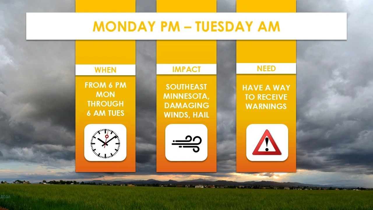
As another low-pressure system rides along that stationary front Monday evening, the atmosphere will turn unstable. The National Weather Service has highlighted a Marginal Risk (Level 1 of 5) for severe weather. The timing of things looks to be late Monday through early Tuesday morning. This is primarily for South Eastern Minnesota.
The Pattern Shift:
Overnight, what we thought was spring holding on ends. A strong cold front will move through, shifting our winds to the northwest. You can anticipate a breezy and cooler day with afternoon highs returning to near normal in the 40s and low 50s.
Eyes on the Weekend:
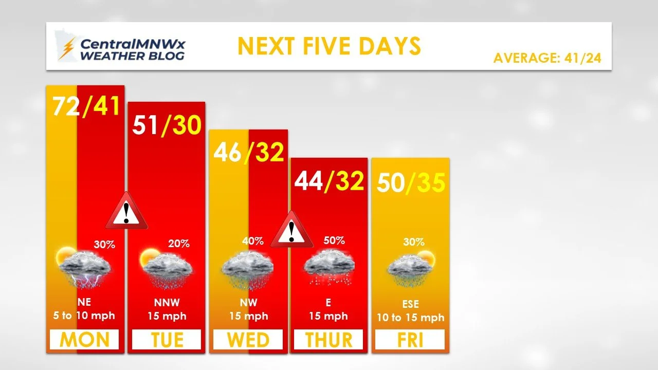
The most complex part of the forecast arrives Friday into Saturday. We are tracking a deep trough of low pressure into the Central U.S. that will bring widespread precipitation to the Upper Midwest.
While the system will likely start as rain, a phenomenon called “dynamic cooling” - where heavy precipitation actually pulls colder air down from higher in the atmosphere cloud flip the rain over to snow.
Enjoy the record-breaking warmth on Monday, but stay weather-aware during the evening hours for potential hail.